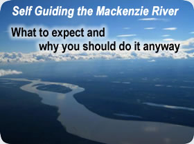
The 1800 km (1120 mile) Mackenzie River (see map) is the longest river in Canada and forms part of the Finlay-Peace-Mackenzie River, the tenth longest in the world. Travelled by First Nations for generations, by the explorer Alexander Mackenzie in 1789, and later by fur-traders, missionaries, and adventurers.
The Mackenzie River passes through the Dehcho Region, by the communities of Fort Providence, Jean Marie River, Fort Simpson (the oldest fur trade settlement along the river) and Wrigley. The river continues through the Sahtu region where you will visit the communities of Tulita, Norman Wells, and Fort Good Hope and then on to the communities of Tsiigehtchic, and Inuvik in the Gwich'in Region and finally through the Inuvialuit Region to the Arctic Ocean and Tuktoyaktuk.
Click here to download an interactive mileage chart. (must have Excel on your pc) This is only a rough guide as it doesn't take in the speed of the current. There is a good current going through Ft. Providence and then there is little current until the river narrows after Mills Lake. You will then have good current until you hit the delta and then it will slow again. The current varies with the water levels. So you would expect the flows to be quicker in June than in August.
Hay River is the perfect location to start your adventure. If you drive to Hay River you can either put your vehicle on the barge and it will be waiting for you in Inuvik or Tuktoyaktuk when you complete your paddle. The barge system MTS is under new management so you will need to them in March to determine when you have to have your vehicle at their dock, the cost is determined by the weight/length of your vehicle. Or you can catch a plane back from Inuvik to Edmonton, Yellowknife or Hay River.
- Hay River to Inuvik takes approximately 4-7 weeks (It has been completed in 3 weeks by two crazy New Zealand paddlers).
- Hay River to Fort Providence takes 4 days (on the road system)
- Fort Providence to Fort Simpson 8-9 days (on the road system)
- Fort Simpson to Wrigley 5 days (on the road system)
- Wrigley to Norman Wells 10-14 days (no road access)
- Norman Wells to Inuvik 10 days (no road access)
- Inuvik to Tuk is 4-7 days depending on wind.
We can drop you off or pick you up at different sections of the river.
The drop off fees are listed here:
| GPS/SPOT/inreach | day | 10.00 |
| Sat phones | mth | 250.00 |
| barrels,dry bags/bear cannisters | week | 5.00 |
| tents | week | 30.00 |
| sleeping bags | week | 20.00 |
| River Charts | $12.00-$20.00 each |
| Lake Charts | $20.00 each |
| Topographic maps | $11.45 each |
| A set of Mackenzie River (1:250,00) topo maps | $250.00 |